|
|
 |
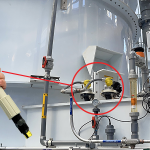
When a Southeast municipality needed reliable level measurement of their coastal canals, they turned to Flowline. The low-lying community is susceptible to flooding caused by rain, high tides and storm surge. To mitigate it, they continuously measure the level height of each canal segment and use this data to balance and redistribute excess water across the canal network via control gates. Measurement reliability is essential, especially during storm events. The I&C engineer required a non-contact, corrosion resistant radar sensor with an SDI-12 signal output that’s a USGS standard in environmental monitoring. That was three years ago, and the sensors have reliably measured through endless tides and major tropical storms. The LR81 radar sensor provides reliable level data to the SCADA, which monitors the canals and controls the gate network. Flowline is reliable level measurement. |
![]()
10500 Humbolt Street
Los Alamitos, CA 90720 USA
562.598.3015 p
562.431.8507 f
level.solution@flowline.com